How we captured an entire highway corridor in a single day using UAV LiDAR and photogrammetry — with no traffic management required.
An aerial LiDAR survey uses a drone-mounted laser scanner to capture millions of precise 3D measurements of the ground and everything on it — road surfaces, verges, vegetation, drainage and nearby structures included. For long, linear sites such as road corridors, pipelines and rail routes, it's increasingly replacing conventional ground survey as the fastest way to collect survey-grade topographic data without shutting down the site to gather it.
This case study looks at how ProDroneWorx used aerial LiDAR, combined with UAV photogrammetry, to survey an entire road corridor for a highways client in a single day — with no traffic management, lane closures or road-side working required to collect the data.
What Is an Aerial LiDAR Survey?
LiDAR (Light Detection and Ranging) works by firing rapid pulses of laser light at the ground and timing how long each pulse takes to bounce back. Mounted on a drone, the sensor records millions of these return points per second, building a dense, survey-accurate 3D point cloud of the terrain below — including ground hidden beneath vegetation, which photogrammetry alone can struggle to resolve. Paired with RTK/PPK GPS positioning, the resulting data is accurate enough to feed directly into engineering design, not just visualisation.
The Challenge: Surveying an Extended Road Corridor
Our client needed accurate, high-resolution topographic data along an extended road corridor to support the design stage of a highways scheme. The corridor's length made a conventional ground survey slow and labour-intensive, with the added complication of working safely alongside live traffic — while the design team still needed survey-grade accuracy to work with confidence.
Our Approach: Combining UAV Photogrammetry and LiDAR
ProDroneWorx captured the entire corridor in a single day using a combined UAV photogrammetry and LiDAR survey. Flying the route rather than walking it removed the need for extended road-side working and lane closures, while still delivering the point density and accuracy the design team needed.
The same one-day model applies directly to other long, linear sites — pipeline corridors, rail and highways alike — where the survey footprint runs for kilometres rather than metres.
No Traffic Management Required — a Major Saving on Cost and Paperwork
One of the biggest practical benefits of surveying the corridor by air was one most clients notice straight away: no traffic management was needed to collect the data.
A conventional ground survey working within or alongside a live carriageway would typically need a traffic management (TM) plan — lane closures, cones, signage, and often a banksman on site — sourced from a TM contractor. In the UK, work that affects the public highway also usually needs a permit from the local highway authority under the councils' permit schemes, with its own application, notice period and fee before work can start.
Because the survey was flown rather than walked, none of that applied. There was no TM plan to design, no contractor to book, no permit application to submit and wait on, and no closure notice period to build into the programme. That saving shows up twice: directly, in the TM hire and permit fees that never had to be spent, and indirectly, in the admin time and lead time that would otherwise go into planning and approving a closure before survey work could even begin.
What the Survey Delivered:
-
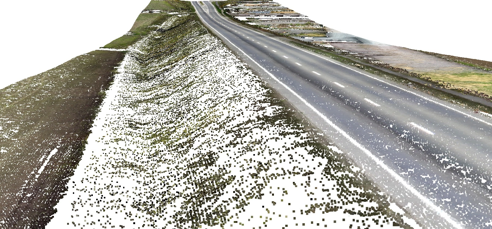
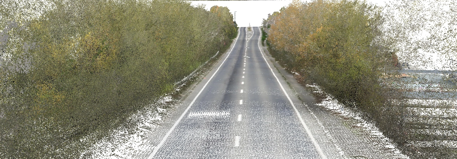
A Digital Surface Model (DSM) — capturing the corridor as it exists, verges, vegetation and structures included, for context and visualisation.
-
A Digital Terrain Model (DTM) — the bare-earth surface beneath, used directly for earthworks and drainage design.
-
A classified point cloud — giving the design team a full 3D dataset they could interrogate themselves rather than relying solely on our interpretation.
-
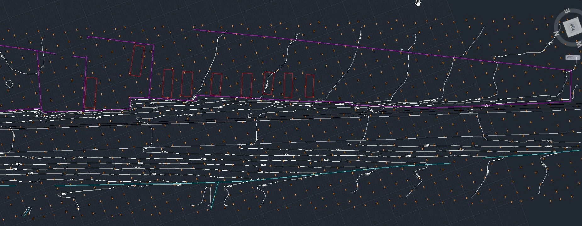
A 2D CAD survey file — ready to drop straight into the design team's existing highway design software, with no rework or format conversion.
Why aerial LiDAR Surveys Matter for Road Projects
The client had a complete, survey-grade topographic dataset covering the full corridor from a single day on site. No traffic management, lane closures or extended road-side working were required to collect it, and because the data was delivered in the formats the design team already used — DSM, DTM, point cloud and 2D CAD — it moved straight into design without a translation step in between.
Compared with a conventional ground survey, that combination of speed, no traffic management overhead, and design-ready outputs is the main business case for aerial LiDAR on road schemes: less time on site, less disruption, less paperwork, and no accuracy trade-off.
Beyond This Survey: One Dataset, Reused Through the Scheme
The same approach carries beyond the initial design stage. Because the DSM, DTM, point cloud and CAD outputs stay in the same formats throughout, the dataset from an initial survey can be reused for construction monitoring and reinstatement verification later in a scheme — without re-surveying ground crews have already covered, and without needing a fresh traffic management plan each time.
Talk to Us About Your Next Road Survey
Whether it's resurfacing, realignment, a junction improvement, drainage works or a wider highways scheme, aerial LiDAR survey can cover the full length of your site in a fraction of the time a ground survey would take, without the cost and paperwork of traffic management. Get in touch if it would be useful to talk through how this could apply to your current programme.